Location map and directions

Keppel Street building floor maps
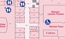 Lower ground floor map (PDF)
- Ground floor map (PDF)
- First floor map (PDF)
- Second floor map (PDF)
- Third floor map (PDF)
Getting here
By Tube
Nearest Underground Stations are: Goodge Street (Northern Line),Tottenham Court Road (Northern and Central Lines), Russell Square (Piccadilly Line), Euston Square (Circle, Metropolitan and Hammersmith & City Lines) and Warren Street (Northern and Victoria Lines).
By Bus
Buses 10, 24, 29, 73, 134 and 390 stop in Gower Street, southbound, and Tottenham Court Road, northbound. Buses 1, 8, 14, 19, 25, 38, 55, 98, 176 and 242 stop in New Oxford Street and buses 7, 59, 68, 91, 168 and 188 in Russell Square.
By Rail
Euston, St Pancras and King's Cross are a short walk (10-15 minutes) from the School's buildings. Other London mainline stations are a short tube, bus or taxi journey away.
By Road
There is no parking at any of the School's sites. There are parking meters and pay and display bays in nearby streets but they are expensive and regularly patrolled. In addition, there is a daily Congestion Charge for driving into part of Central London and the School is within this zone.
Designated bicycle parking stands are available on the pavement in Keppel Street, Malet Street and on Bedford Square.
By Air
From Heathrow the Piccadilly tube line runs to nearby Russell Square (approximately 45 minutes) or a rail link, the Heathrow Express, runs from Heathrow to Paddington (approximately 15 minutes), from there take the tube (Circle Line) to Euston Square. From Gatwick trains run into Victoria station (approximately 30 minutes) where tube trains, taxis or buses are available. From City Airport there is a shuttlebus link to Liverpool Street, from there take the tube (Central Line) to Tottenham Court Road.
Useful links
The School accepts no responsibility for content on external websites. Links open in a new window.
- Transport for London's Journey Planner (for all public transport as well as cycling and walking)
- National Rail Enquiries
- TheTrainLine
- London Congestion Charging
- Camden Council's Parking Information
- Parking for Blue Badges


